|
Tahoe Nugget #221:
Pacific Storm Door Opens
January 18, 2012
It took only one inch of snow to break the region's record streak of winter days with no precipitation. On January 16, parts of the Sierra and western Nevada picked up between a trace and two inches of
snow.
The one inch of snow that fell on Squaw Valley USA was the first measurable snowfall in more than a month there. The season's cumulative total on the upper mountain is only 26 inches; and nearly one
third of that fell in the first week of October, more than three months ago.
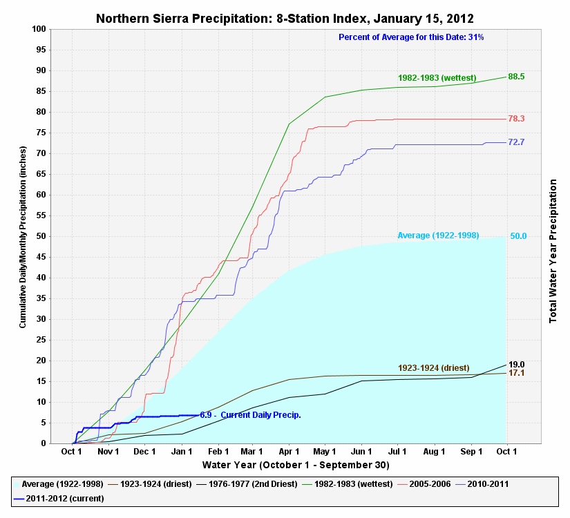
This 8 Station Index graph was plotted for the wettest winter (1983); 2006 and 2011 (Top 10 Winters); and 1924, 1977 and 2012 (Driest Winters on Record). Index was established in 1920.
At the Reno-Tahoe Airport, the less than half an inch of white stuff that coated the tarmac two days ago was the first precipitation since
November 20, and it ended that location's longest winter dry spell in recorded history at 56 days. The previous record was 54 days that ended on January 24, 1961.
A bit further south in Minden, Nevada, the record dry spell topped out at 72 days. The Carson River basin snowpack is currently at 8 percent of average, compared to 224 percent last year at this time.
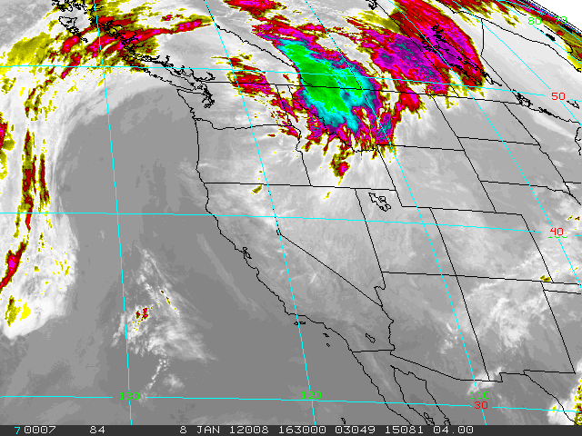
Infrared satellite image from 4 kilometers shows blocking high pressure.
According to the 8 Station Index, established in 1920, December 2011 was the second driest on record. The Index is an aggregate of
data from eight locations from Highway 50 in the south to Mt. Shasta in the north and represents precipitation values in the central and northern Sierra Nevada.
The unusually persistent ridge of blocking high pressure has delivered an unbelievable string of sunny days during one of the statistically wettest times of year in the Tahoe Basin.
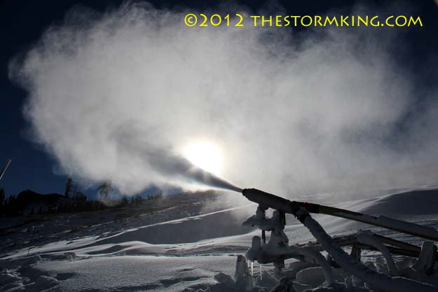
High powered snow gun working its magic at Alpine Meadows on Jan. 12, 2012.
Waking up each morning to bluebird skies, day after day, reminded me of the movie Groundhog Day, where actor Bill Murray gets
locked in a repeating time warp in Puxatawney, Pennsylvania. Indicative of the total shutdown of the winter storm track, even Donner Summit picked up only 1.5 inches of snow during the whole month of December.
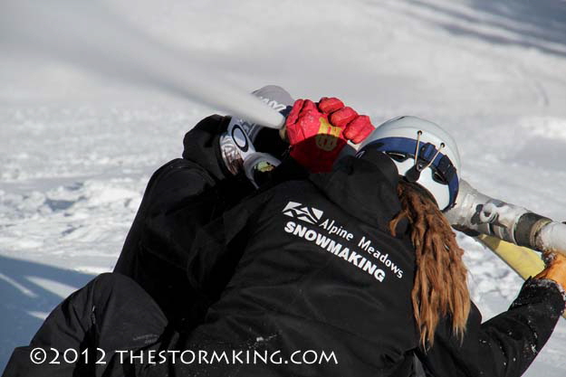
Wrestling a pressurized snow gun while it's blasting away can't be easy.
Despite the dearth of snowfall, Tahoe resorts have cranked up their snow making machinery and the skiing and snowboarding conditions
have been remarkably good considering the Storm King's stingy nature this season. After a string of record high temperatures in late
December and early January encouraged boaters back onto area lakes, cooler weather moved in and Alpine Meadows was able to blow
enough snow to open their Summit Chair on Jan. 13 to offer top to bottom skiing on their mountain. By this time last year, they had already picked up 25 feet of powder.
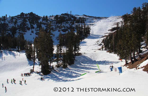
Looking up at Alpine Bowl where snow making is making a big improvement.
The real game changer, however, begins this weekend when the jet stream is projected to aim a hose of subtropical moisture directly at
the Northern Sierra. The National Weather Service is forecasting the possibility of up to six inches of water near the Sierra Crest by
Monday. Depending on snow levels, which are expected to fluctuate as a series of low pressure waves rip through the region, the upper
elevations could easily pick up a yard or more of new snow. Ridge-top winds will gust in excess of 100 mph.
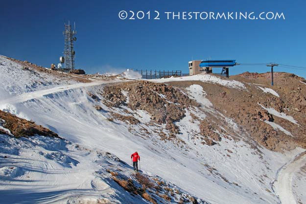
Alpine Meadows opened the Summit Chair (visible) the day after I took this shot.
Due to its high moisture content, the expected snowfall this weekend will be more like Sierra Cement than Rocky Mountain powder, but
resorts actually prefer the heavy wet stuff to make for a solid base with the drier, fluffier stuff on top.
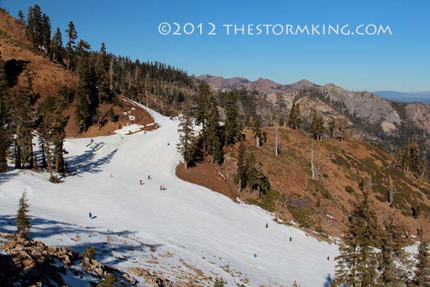
Note bare mountains north of Alpine Meadows Resort.
No matter what the snow is like, Tahoe locals, visitors and businesses can't wait to get something going, and this week's pattern change is just what the doctor ordered.
|


