|
Tahoe Nugget #219:
Snowless in Tahoe: Weather Update
December 21, 2011
Welcome to the first day of Winter!
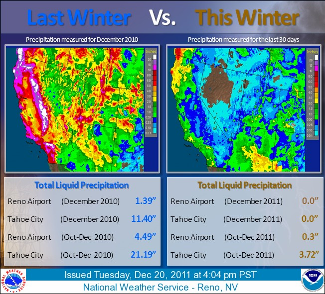
Following on the heels of the epic winter of 2011, the ninth snowiest since 1879, winter 2012 is off to a slow start in Tahoe. Both winters are influenced by La Niña conditions in the equatorial Pacific,
but so far the similarity ends there. The highly amplified high pressure ridge in the eastern Pacific is shunting storms to the north and east of the Tahoe region.
Graphic detailing the dramatic disparity between 2010 & 2011.
Last year a dome of higher pressure was centered further west, and its clockwise air flow steered cold wet storms
down from the Gulf of Alaska and into the Sierra Nevada. Storms this year, however, have been tracking farther
east, and overland into the Great Basin. The overland trajectory has starved these early season low pressure systems of moisture and energy.
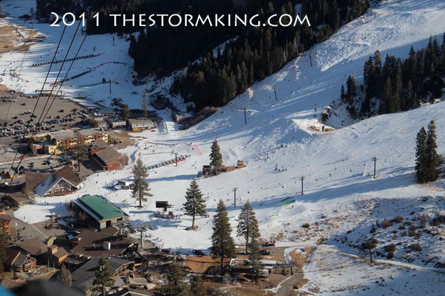
Aerial image of limited skiing terrain at the base of Squaw Valley.
The Tahoe region has been bone dry since the Thanksgiving holidays. Some pundits have claimed that natural
snowfall before the Christmas holidays is just a bonus, but the total lack of moisture since late November is actually
a rare event. This is statistically a very active time of year weatherwise and it's highly unusual to go so long without a storm.
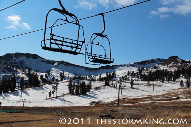
Squaw Valley USA is waiting for snow to open the upper mountain.
Consider the time slot between Nov. 25, when a weak weather system brought a little bit of snow, and Dec. 15
when another inside slider type storm sprinkled Donner Summit with less than a tenth of an inch of precipitation.
During those 20 days, no precipitation fell at many locations throughout much of California. This year was only the
third time since 1940 that nothing was measured at Blue Canyon; only the second time since 1906 at Chico; and it
had never happened before at Red Bluff since records began in 1892. It was only the fifth time in Sacramento since the gold rush era in 1850.
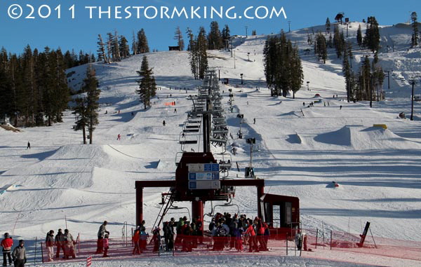
Aggressive snowmaking enabled Boreal Mountain Resort to offer top to bottom skiing.
One likely culprit is the Arctic Oscillation (AO) which affects atmospheric pressure in the Pacific Ocean. In 2011
the AO was in a negative phase, which enhanced an extended period of lower pressure (storminess) in the mid
-latitudes of the eastern Pacific (our region of the world). That negative phase contributed to last winter's persistent snowfall pattern.
Snowmaking at Homewood Mountain Resort enhances the snowpack in 2010.
So far this year, the AO is in a positive phase which tends to support higher pressure (fair weather) in the mid
-latitudes. The Climate Prediction Center is forecasting the AO to remain positive for the remainder of December.
It may seem counterintuitive, but precipitation (rain and the liquid content of snow) so far this water year is actually
close to average. The Central Sierra Snow Lab at Soda Springs received 8.32 inches of precipitation in October
and November, compared to 9.15 inches normal for that time period. What is missing is the nearly 10 feet of snowfall normally received at the lab by New Years Day.
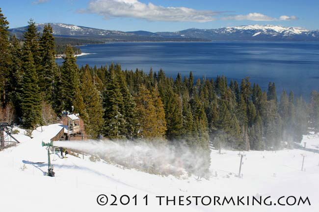
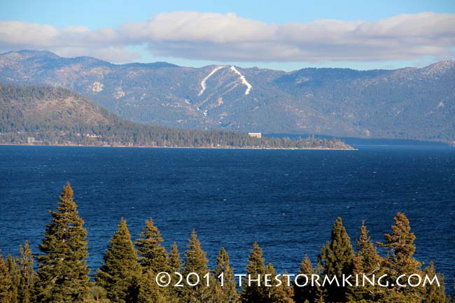
Diamond Peak has opened its spectacular lake view ridge run using snowmaking technology.
At this time last year, the upper elevations at Squaw Valley had already been blasted with more than 20 feet of
snow. Squaw Valley hasn't picked up any natural snowfall in more than a month. The upper elevations have
received only 24 inches of snowfall since early October, and more than half that fell long before the resort opened.
Fortunately, snowmaking technology has enabled most local areas to open quite a few trails for skiers and snowboarders to enjoy.
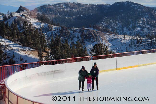
Ice skating at Squaw Valley's rink located at elevation 8,200 feet
NOAA's prediction for the next three months calls for average precipitation in the Tahoe region. In general, the
main impacts of La Niña-influenced winters are felt later in the season, from January to March so skiers must be patient. In the meantime, keep those snow guns fired up.
|


